
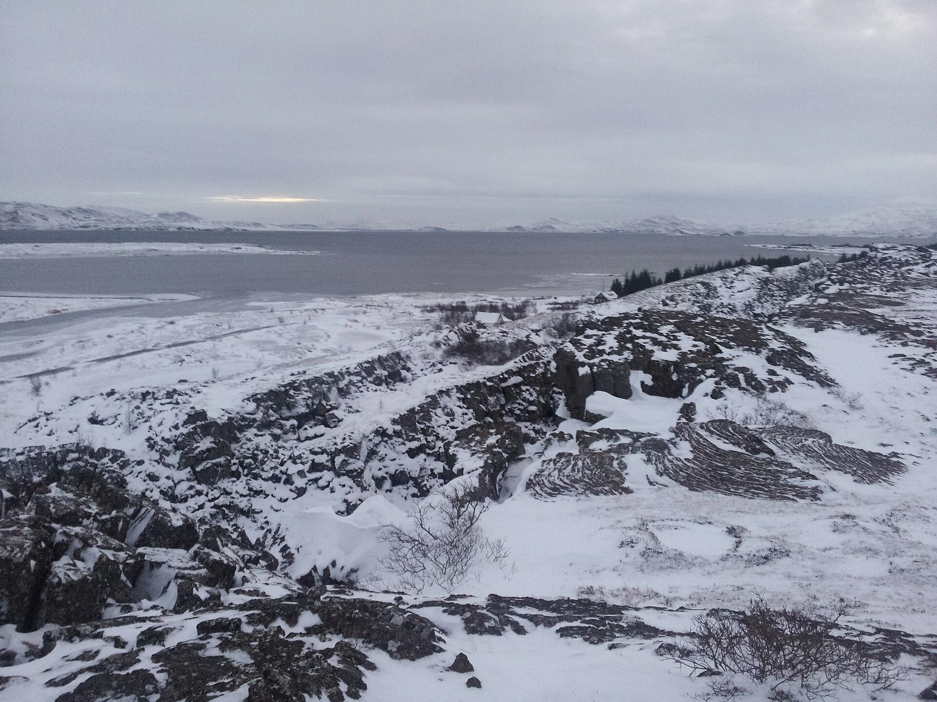
Lake Thingvellir: Viewpoints and Shore Access
Understand Þingvallavatn, choose a permitted lake view, and separate shoreline visits from fishing or water activities with their own rules.
“Lake Thingvellir” usually means Þingvallavatn, the lake at the southern end of the park's old meeting area setting. It is not another name for Silfra. A lake view, a shoreline walk, fishing and a booked fissure activity are different plans, even though each connects with the same water system.
Use Þingvallavatn as the name when checking a map or asking for directions. Start with an allowed view from the marked park route, then decide whether a shoreline stop adds anything to your day. Check fishing permits and activity rules separately. The water is cold, clear fissures can conceal steep drops, and a photo of the shore is not proof of public access.
Last fact checked: 14 October 2026. Access and permits must be checked again before your visit.
Which lake Thingvellir visitors mean
Þingvellir is the park and assembly place. Þingvallavatn is the lake. The similar names can cause confusion when searching for a hotel, choosing a map pin or reading an activity account. Silfra is a fissure at the lake's northern end, rather than a distinct large lake beside it.
The park's watershed account places the lake in a rift valley. It sets out the lake and a much larger catchment, the area from which water reaches it. The catchment matters because much of that flow arrives underground, rather than as a river you can follow from the shore.
Use the lake's Icelandic name to check that a source sets out the right place. A general listing “near Thingvellir” may cover a wide area. It does not tell you which shoreline, road or public approach a photo uses. Match the named place to the actual route before relying on it.
For the geological setting, read the tectonic plates guide. The lake and fissures sit within a broad rift system. Seeing clear water between rock walls does not make every narrow gap a complete boundary between continents.
Choose a lake view before a shoreline route
A broad view helps you place the water in the wider valley. The visitor centre at Hakið is next to the viewing platform, where the route leads down toward Almannagjá. Check latest conditions if you plan to use the path, especially when snow or ice affects walking.
That view can meet a visitor's needs without a drive to several points around the lake. If your main interest is the meeting area, keep the lake as context for the history walk. If the lake itself is your priority, use the official map to choose an allowed approach with the kind of view or route you want.
Do not assume that all land between a road and the water is open for stopping. Parking, foot access and shore use are distinct questions. A cottage road or informal track may not be a public visitor route. Signs and the latest official map take precedence over an old photo pin.
The park's parking page names lots that serve the old meeting area. It does not make every verge along the lake a place to park. Stop where the vehicle can be left lawfully, then use a marked route. Avoid stopping on the road simply because the water looks good from that angle.
Shoreline choices for different visits
Start with what you want to do, rather than a collection of viewpoints. A history walk needs a lake view that fits the assembly route. A photographer may want an allowed stop with a clear foreground. An angler needs the correct permit and fishing area, not just an attractive edge of water.
- For an old meeting area visit: keep the lake as part of the view and route. Add Althing account to read how water and the gathering grounds relate.
- For a quiet stop: choose a marked public approach and check that its path is open. Do not use private access to avoid other visitors.
- For fishing: read the park's latest angling details before selecting a place or buying a permit.
- For Silfra: use the booked activity's exact instructions. A lake viewpoint is not its meeting point.
- For an overnight base: check the actual property location and roads. Our hotel comparison separates named stays by useful fit.
For a walk, the return is part of the route. A path that descends toward water may ask more effort on the way back. Allow time for that, and turn back before conditions or daylight make the return harder than you planned.
Why the lake's water system matters
The park explains that lava and faults affect the movement of water into Þingvallavatn. Water can travel below the surface before emerging in fissures and springs. This connects the lake with the geology you see on land, while helping explain why some water-filled cracks are so clear.
The official lake account sets out how the volcanic ground and water create varied habitats. Fissures and gaps along the shore can shelter fish and other organisms. They also mean a shoreline is not just a flat margin between dry land and shallow water.
The fish account sets out brown trout and forms of Arctic charr. Treat those as part of the lake's ecology, rather than a promise that you will see or catch one at a chosen stop. Fishing access and permits remain distinct from the biological account.
Avoid treating clear water as a test of drinking safety or a reason to enter it. The visibility of the bottom can make distance and drops hard to judge. A planned viewpoint is enough for a normal sightseeing visit. Water activities require their own plans and equipment.
Facilities and seasonal limits
Check where services are before you leave the car. The Leirar service centre has a service desk for park details and permits. It is different from the visitor centre at Hakið. Use the right name when checking opening hours or asking where to go.
The latest park page gives different seasonal service-centre hours. Recheck them for your date rather than carry them forward from a past trip report. A permit desk being open does not show that every route or shore activity is available in the same period.
Winter can change what is visible and what is useful. Snow may hide path edges, ice can affect footing and short daylight reduces spare time. Do not treat a summer lake photo as a winter access guide. Check the weather and park notices, then shorten the route if needed.
If you want transport rather than a self-drive visit, compare Thingvellir tours by their actual stop account. A park stop may allow only a view from the assembly route. Ask about a lake visit if that is your main reason for choosing the excursion, rather than infer it from the word “Thingvellir.”
Protect the lake during a visit
Keep litter and food waste with you until you reach the right bin. Do not throw coins into fissures. A tradition mentioned in an old account is not a reason to add metal to the water today. The park's assembly-site account explains the history of coin throwing without making it a visitor task.
Use marked paths rather than wear a new route through vegetation. A short shortcut can damage the edge of a feature that looks tough from a distance. If signs close an approach, choose another allowed view. A desirable photo does not make a closure optional.
Keep wildlife observation distinct from feeding. Look from the route and avoid handling animals or moving rocks to find them. The park's lake pages explain the habitat in ways you can read even when you do not see fish or other organisms yourself.
Use honest photo captions. Name the lake, the actual viewing place if known and the season. If a picture is older, do not imply it shows latest water, weather or access. That distinction is useful for the next visitor who tries to plan from your image.
Frequently asked questions
Is Þingvallavatn the same place as Þingvellir?
They are related but different names. Þingvellir is the park and assembly place; Þingvallavatn is the lake. Silfra is a fissure near the lake's northern end. Use the exact name when checking a route or activity. A broad “Thingvellir” listing may not point to the shoreline you have in mind.
Can you see the lake without a water activity?
Yes. A allowed view from the marked park route can show the lake in its wider setting. Snorkelling or diving is a distinct activity with its own checks. Decide whether you want a view, a walk or time in the water first, then use the correct access details for that choice.
Does a fishing permit allow any shoreline access?
Do not assume that. Read the latest permit conditions and the park's angling details for the areas and rules that apply. Parking and land access need their own checks too. A permit is not a general right to use private tracks, leave a car anywhere or ignore a closed route.
Is a lakeside hotel inside the old meeting area?
Not necessarily. Properties listed near Þingvellir may be elsewhere around the lake or farther along the Golden Circle. Check the named hotel's official location and your driving route. A lake view and a convenient approach to the meeting grounds are different benefits, so decide which matters most for your stay.
Verdict on Lake Thingvellir
Plan Lake Thingvellir as Þingvallavatn: a lake with its own shores, water system and rules. Start with one allowed view and add a walk only if it serves your day. Treat fishing and Silfra as distinct activities. The park overview helps put that choice alongside the meeting grounds and your transport plan.
The Thingvellir church guide explains another stop on the old meeting grounds. Check entry separately from the lake view.
