
Thingvellir National Park Photos: Viewpoints Guide
Recognise Almannagja, the church and Oxararfoss in credited real photographs. Plan lawful viewpoints and keep image evidence separate from current access.
Thingvellir National Park photos are most useful when they name the place and explain the allowed viewpoint. Almannagjá, the church, Öxarárfoss and the lake each tell a different part of the visit. Use the credited photos to spot each place. Use the map and current signs for your route.
Choose a photo by the feature it explains, not only the dramatic view. Stay on marked visitor routes and read current barriers before choosing a camera position. A past image does not prove today's access or weather. The real-place photos carry credits. The planning hero has its own label. It does not show park terrain.
Sources and image records checked: 15 October 2026. Orientation comes from the park's hiking and map page. Each real image has a Wikimedia Commons source and licence below.
The photos document their subjects when taken. They do not establish present path access. Credited CC images use CC BY-SA 4.0; the church image is public domain.
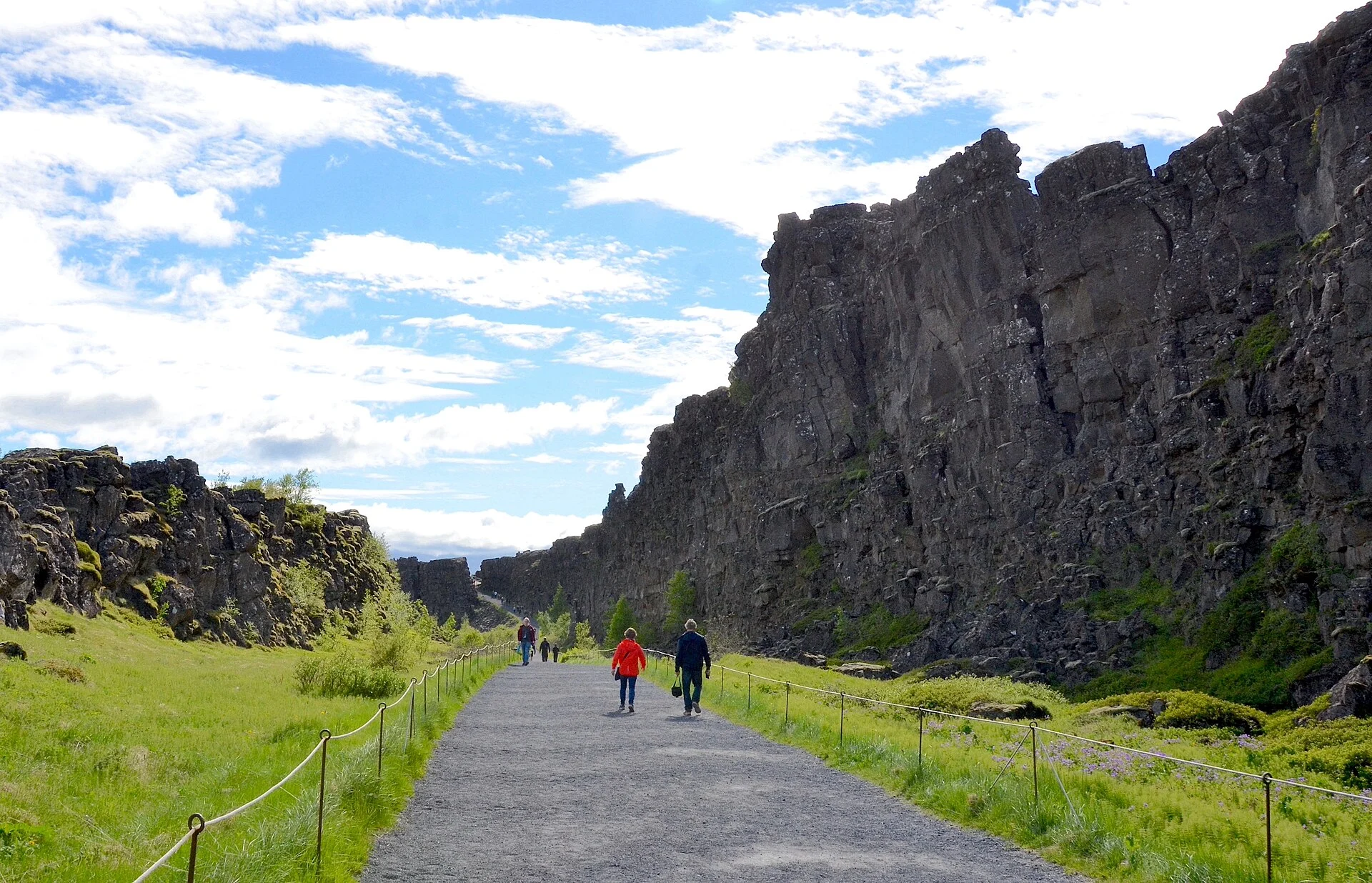
Thingvellir National Park photos: the Almannagjá route
Almannagjá's rock walls make a clear part of the main visitor walk. Read the rift explanation before using a caption about continents. The visible fault belongs to a wider rift zone. One photo cannot show the whole plate boundary. Avoid a false edge-to-edge claim.
Choose your position from the open visitor path. Do not move onto fragile ground to copy the camera angle. Other walkers need space as well. Keep photo stops clear of a narrow path. Leave room for people to pass.
Church and assembly-area photographs
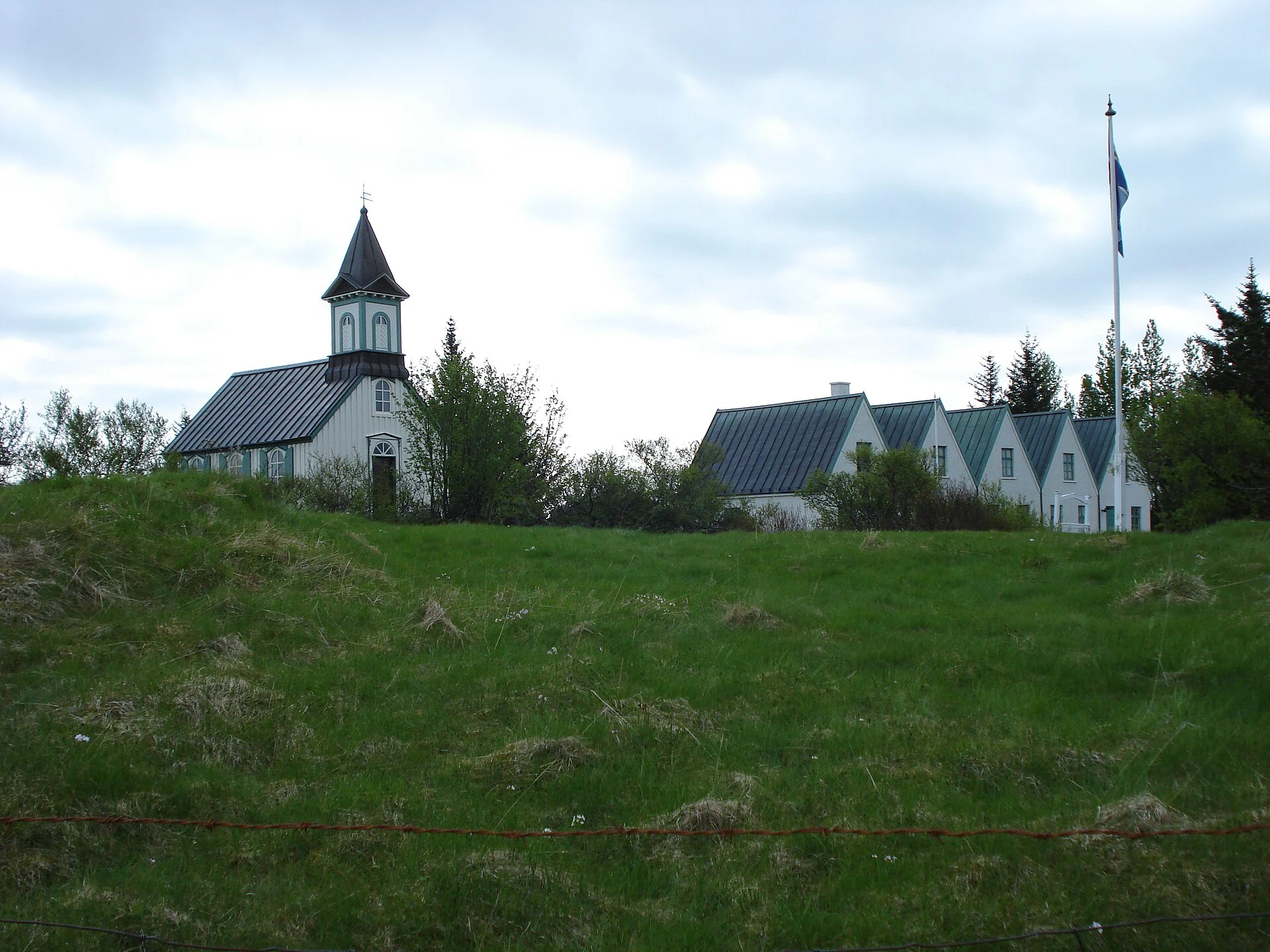
The church is a later building within the historic setting. Read the church account for the distinction between the present outside and the older story of worship at the site. An outside photo does not establish inside access for the date you plan to visit.
The low booth remains and assembly places need a different kind of image from a broad church view. Read the Althing guide to understand what a marker or earthwork represents. Do not label every old-looking structure as a surviving building from the first assembly.
Use the map to name the feature accurately
Keep the park overview and official map available when choosing captions. Lögberg, booth remains and the church have different meanings. A general label such as old parliament can hide those distinctions. Use the name and the exact feature actually shown.
If you cannot name a detail with confidence, leave it unnamed rather than invent a story. A photo can help name the place. It cannot settle every history question. The text and park sources should carry that work.
Öxarárfoss and water viewpoints
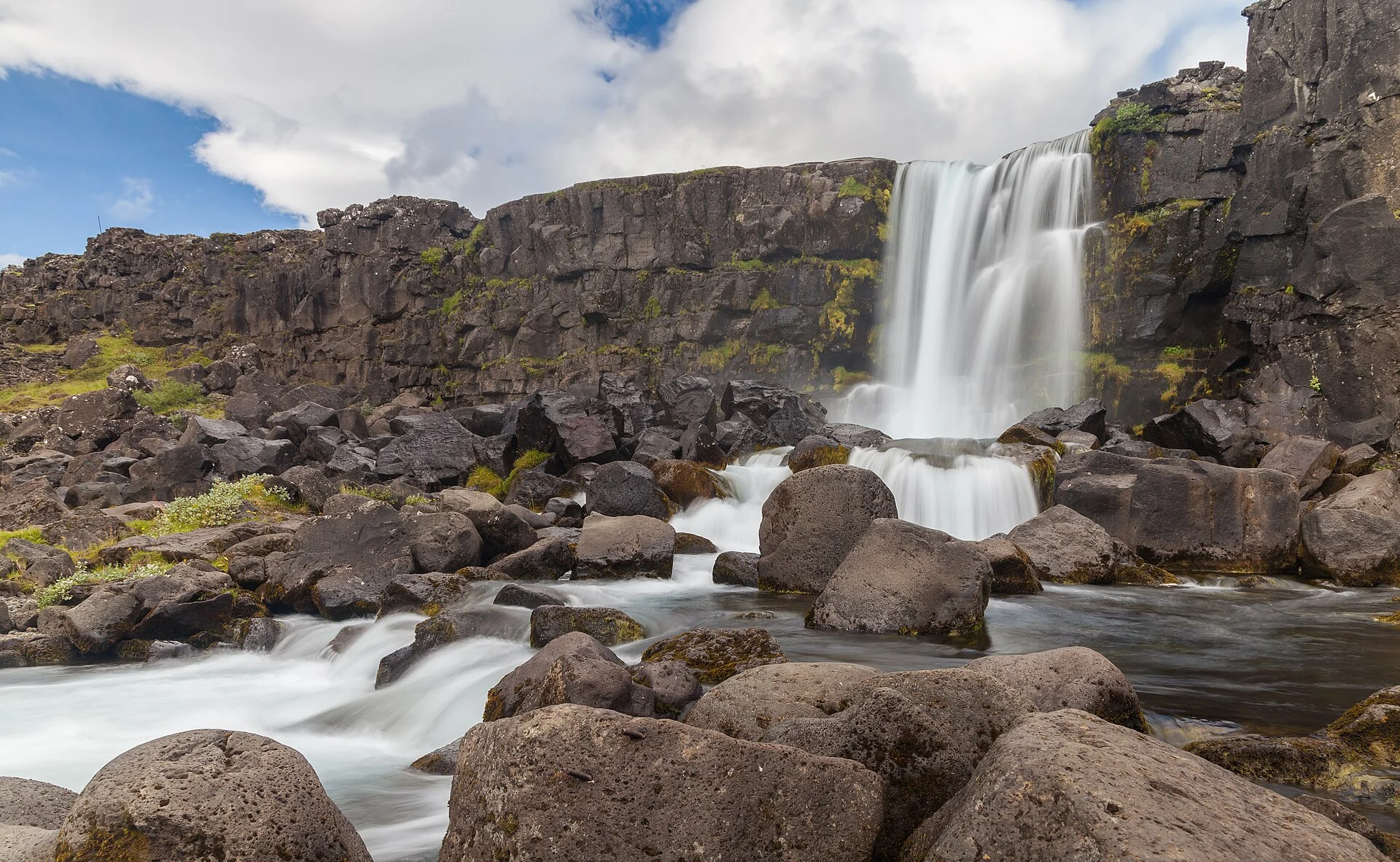
Öxarárfoss is a distinct waterfall visit within the park. The walking guide connects it with the marked approach and the return. A close view of the falls leaves out the walk. Check the steps and return before you go. Check current access before setting out.
For the lake, use the Þingvallavatn account to separate a land view from water activities. A camera position by the shore is not permission to launch a boat or enter a fissure. Fishing has its own permission too. Choose the allowed visitor route for the kind of visit you are making.
Seasonal light does not establish seasonal access
A winter photo can show snow without proving that the path to its viewpoint is open today. A summer image can hide how wet or exposed a route becomes. Use current signs and the weather guide before deciding which approach fits the party.
Allow time to stop and put the camera away before returning. A photo-focused visit still needs a walking budget. Do not wait for a perfect light effect until the return no longer fits. The right photo can come from a modest view. Use an open place you can reach and leave with ease.
Drone photography has a separate rule set
Read the drone guide and current authorities before planning drone work. A lawful ground viewpoint does not give flight permission. Nor does a drone image online prove that the same operation is allowed for your gear and date.
Commercial filming and personal use have distinct park guidance. Resolve the purpose and flight conditions before unpacking the gear. Ground photos can meet the goal. Use them when a drone does not fit the rules or the scene.
Credits and a practical photo plan
The image-credits page keeps the full site record. This page also shows the author and licence beside each real photo. The images have been resized and converted for display. Keep those source terms with any further reuse rather than treat a public web image as free to reuse.
- Feature: Identify the place and the subject actually shown.
- Access: Read current signs before choosing the position.
- People: Leave room on shared paths and respect other visitors.
- Time: Keep the return within the walking budget.
- Rules: Separate ground photo work from drone or commercial work.
- Payment: Read the park-service guide for any separate paid activity.
For an extended visit, compare nearby stays by the route. A hotel photo does not guarantee the light at a landmark. If using organised transport, check how much time the itinerary actually leaves for photo work.
Frequently asked questions
Do these photos prove current access?
No. They document the subjects when photographed. Paths and conditions can differ on your date. Use the official map for orientation, then current local notices for access. A past view from a close camera position is not permission to pass today's barrier or a guarantee that the same surface remains suitable.
Is the hero a real photograph of the park?
The planning hero is an AI-generated generic scene, labelled in its caption. The named-place photos within the article are real credited Commons images. Keep those uses distinct. Generated imagery does not establish the terrain or present conditions of Þingvellir, including its facilities, and it is not presented as a visitor's observed result.
Can you reuse a Commons photograph without checking terms?
Read the licence attached to the exact file. Some require author credit and share-alike terms, while a public-domain image has a different status. This page links each source and licence. Keep the resize or conversion statement with the credit where applicable rather than assume all online photos have the same reuse conditions.
Can a drone reproduce an aerial view seen online?
Only if the proposed flight meets current local and national requirements. A photo's existence does not establish permission for your drone, purpose or date. Read the park's personal-use or commercial route and the aviation authority's conditions. Use a lawful ground position when those requirements are unresolved or cannot be met.
Verdict on Thingvellir National Park photos
Use Thingvellir National Park photos to recognise the named features, then the sources to understand them. Keep author and licence credits with real images. For your own visit, choose an open marked viewpoint and a manageable return. A useful photo explains the place without making an unsupported access claim.
Historical photograph; see the dated source record · Resized and converted to WebP; display may crop the edges.
Olga Ernst · CC BY-SA 4.0 · Image source
.jpg)
Historical photograph; see the dated source record · Resized and converted to WebP; display may crop the edges.
TommyBee · Public domain · Image source

Historical photograph; see the dated source record · Resized and converted to WebP; display may crop the edges.
Diego Delso · CC BY-SA 4.0 · Image source
